
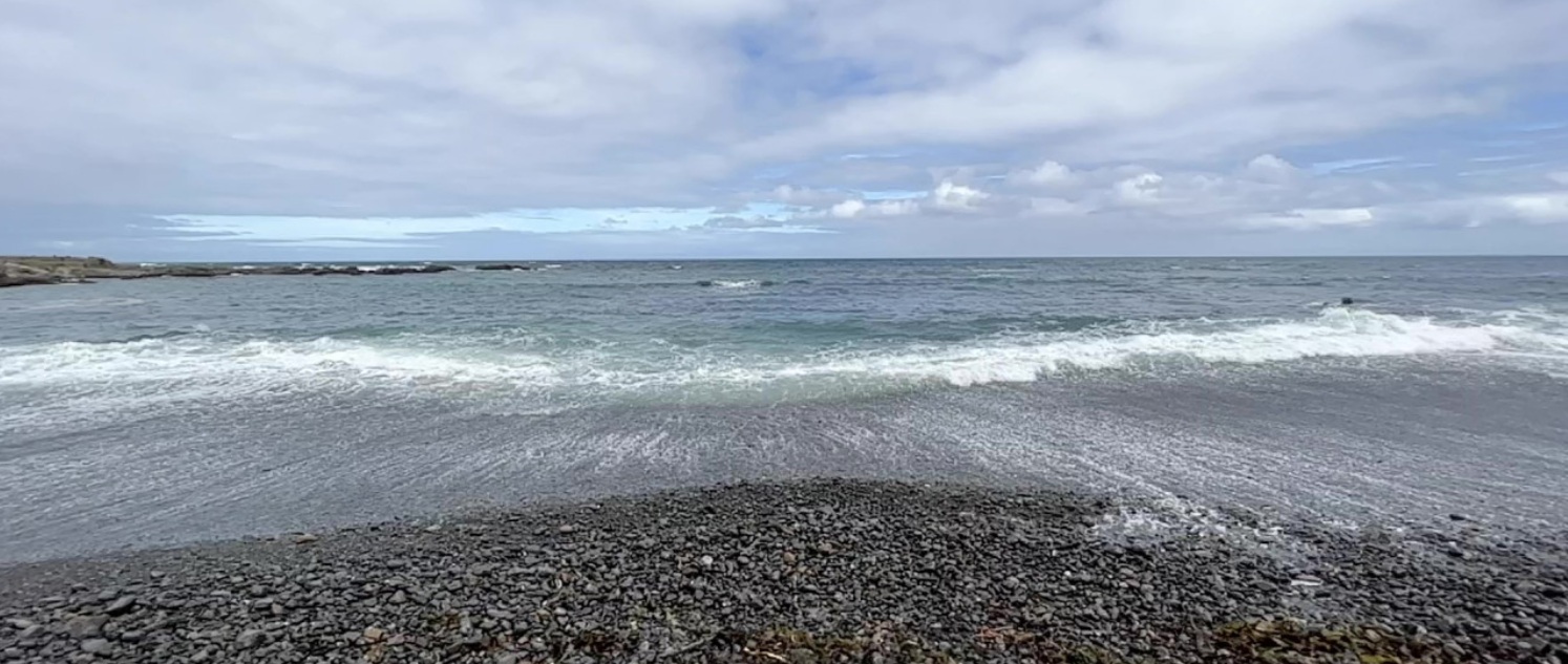
GeoNet has installed a new tsunami gauge at Port Taranaki, strengthening New Zealand’s ability to monitor and respond to tsunami threats along the west coast of the North Island.
The Kamchatka (Russia) tsunami last month couldn’t make it clearer how important these instruments are for providing critical data that informs how the country responds to these events to keep people safe and aware of what’s happening at their shores.
Part of the New Zealand Tsunami Monitoring Network, the gauge fills a critical gap in coverage, providing enhanced visibility of real-time and future tsunami risk in the region.
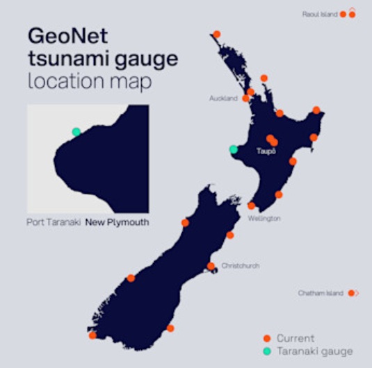
GeoNet tsunami gauge network map
“This installation is a vital step toward improving our national resilience to tsunami hazards,” says Dr David Burbidge, tsunami scientist at Earth Sciences New Zealand.
“The west coast has fewer monitoring stations than other parts of the country, so this gauge gives us a clearer picture of what’s happening in real time and helps us better understand tsunami behaviour during and after an event. This site fills in an important part of our coastal tsunami gauge network – a vital tsunami monitoring dataset in tandem with our DART network and seismic monitoring capability keeping eyes on the open ocean for tsunamis.”
The installation builds on previous work at the port, where a GNSS station was installed in 2024 as part of Toitū Te Whenua Land Information New Zealand’s 3D coastal mapping project. Earth Sciences NZ has now partnered with Port Taranaki to add the tsunami gauge.
The gauge will serve two key functions:
Monitoring: Delivering real-time data to assess current conditions and support emergency response and de-escalation.
Post-event analysis: Providing detailed information on wave arrival times, amplitudes, and propagation to improve scientific models and forecasting.
“This isn’t just about collecting data, it’s about protecting people. Accurate, timely information can save lives and help communities recover faster after a tsunami,” Dr Burbidge says.
“To get the best data, we look for locations with deep water, simple seabed topography, easy access, and proximity to population centres or critical infrastructure,” Dr Burbidge explains.
“Port Taranaki meets these criteria well, making it an ideal site for this installation.”
Port Taranaki Chief Executive Simon Craddock says the port is more than happy to assist the tsunami monitoring programme and help safeguard the community and region.
As well as providing an area near the end of Blyde Wharf for the tsunami gauge componentry to be installed, Port Taranaki has also led the on-site project management, facilitating the site work around shipping movements.
“As a lifeline utility, Port Taranaki has a key role to play prior, during and post natural events, so having technology on-site that will help give our community vital information and contribute to time critical advice should a tsunami occur is invaluable,” he says.
“We’re also a west coast port, exposed to often challenging conditions, so we know the importance of monitoring and gathering information that helps develop our knowledge and understanding of weather, sea and swell activity.
“This is an important tool, and we look forward to working with Earth Sciences New Zealand as the monitoring proceeds.”
Watch the Seven Sharp story on the installation to see how we work with industry and emergency management to help keep New Zealand safe from tsunamis.
About the Taranaki tsunami station
The station includes:
Two pressure sensors in protective housing.
Armoured sensor cable run
Data recorder
12V and 24V power supply systems
Dual communication systems (cellular and Satellite)
Large cabinet
Sensor installation:
Structure-mounted: The sensor is fixed to existing marine infrastructure (e.g., wharves) with cabling protected by steel piping.
NEMA are the official source of tsunami warning information in New Zealand. For information on preparing for earthquakes or tsunami, there are guidelines from the National Emergency Management Agency's (NEMA) Get Ready website.
Learn: About tsunamis, learn the warning signs and the right action to take
Find: Your tsunami evacuation zone
Read: A tsunami isn’t just a big wave
We can’t prevent natural hazards, but we can, and should, be prepared for them
Remember Long or Strong, Get Gone : If you are near the coast, or a lake, and feel a strong earthquake that makes it hard to stand up OR a weak rolling earthquake that lasts a minute or more move immediately to the nearest high ground or as far inland as you can, out of tsunami evacuation zones.
For information on preparing for earthquakes or tsunami, there are guidelines from the National Emergency Management Agency's (NEMA) Get Ready website.
NEMA are the official source of tsunami warning information in New Zealand.
Prepare your home. Protect your whānau. There’s a lot we can do to make our homes safer and stronger for earthquakes. Natural Hazards Commission Toka Tū Ake's website has key steps to get you started.
LATEST POSTS
- Tonkin + Taylor Group 2025 Sustainability Report
- Preserving the Cook Islands for Future generations
- Discovery of hidden faults sheds light on mystery of 'slow earthquakes'
- Filling the gap- Port Taranaki tsunami gauge enhances national monitoring network
- Solomon Islands Prime Minister hosted by Wellington business
- Rain from tropical cyclones to increase under warmer climate
- Value beyond compliance- GRI’s updated Standards as a compass for meaningful climate action
- Presentation of Natural Hazards Inc at Blue Forum well received
- Ventech Systems joins Natural Hazards Inc
- Distinguished Professor David Johnston of Massey University's Joint Centre for Disaster Research has passed away
- Building Climate Resilience in the Marshall Islands
- GNS Science readying Aotearoa for the next ‘big one’
- Unusual disturbances above Antarctica bring winter north
- Aon 2024 Client Trends Report, including weather and climate analytics
- July 2024 marks 25 years of issuing the Seasonal Climate Outlook
- NIWA scientists find evidence of sediment impacts on seafloor ecosystems following Cyclone Gabrielle
- World-leading innovation recognised in Beca clients on awards night
- Egis wins at 2024 Property Awards
- Presentation on Coastal Management in the coral island setting shines a fresh light
- Beca announces a key leadership role with new Country Manager for Fiji
- Egis – 'Transitional Opportunities' presentation by Peter Ollivier on 28 March